Tropical Storm MAYSAK/Chedeng
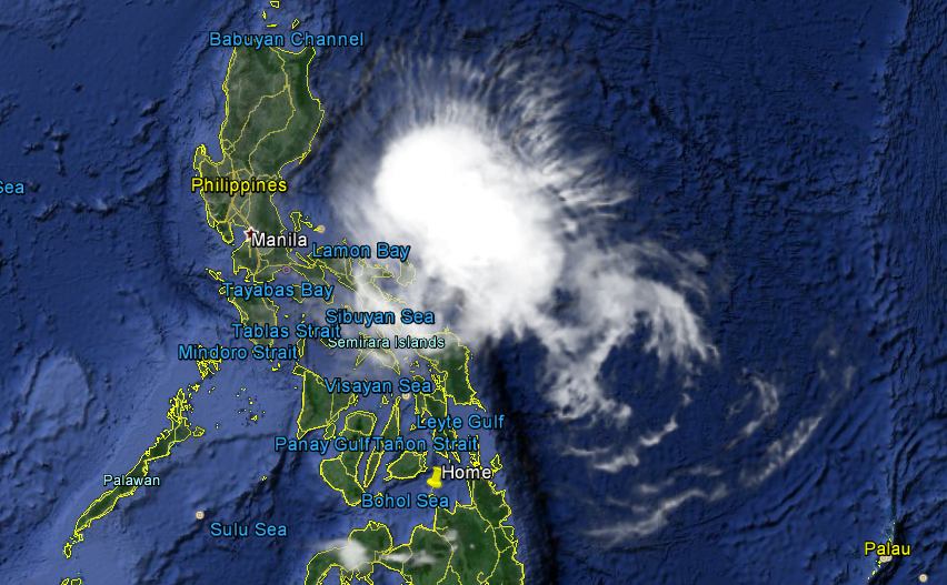
Tropical Storm MAYSAK/Chedeng – Lucky Philippines again. The monster typhoon seen this week approaching our islands has lost most of its destructive energy.
The Doppler radar stations on the east coast report light to medium rainfall.
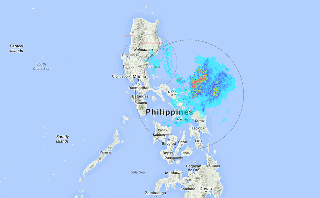
This Doppler radar information is available on Project NOAH.
Landfall is expected in the vicinity of Palanan Bay in Isabela province around 7 to 11 a.m. tomorrow morning. The winds will still be strong enough to damage light constructions e.g. Nippa roofs and Amakan walls. The storm lost a lot of the water it carried in from the Pacific. Rains are expected to reach 30 to 200 mm in 24 hours.
Good night for now and good luck to the people living on the coast in Isabela.
[GARD]
Related posts
 April 5, 2015 Tropical Storm MAYSAK/Chedeng – before landfall Tropical Storm MAYSAK/Chedeng behaved strangely last night. It almost lost all of its energy and got completely disorganized. But this […]
- June 27, 2013 Solar Energy Initiative This morning we got an interesting e-mail and were asked to publish its content. We do it with pleasure.
Hi
Due to many brownouts and […]
- September 28, 2014 A Saturday morning dive – CANON PowerShot G-12 Yesterday I published some pictures of our Saturday underwater stroll. I got very motivating feedback and you asked lots of […]
- August 10, 2013 Tropical Storm UTOR / Labuyo getting stronger During last night Tropical Depression 11W / Labuyo has strengthened and is now a Tropical Storm called UTOR / Labuyo. It continues to move […]
- January 23, 2015 Bridge in Balingasag repaired PIA reports: Alignment of the Mambayaan Bridge I in Balingasag town, Misamis Oriental has been restored to its original condition as of […]


Recent Comments