The Earth is still shaking in Negros
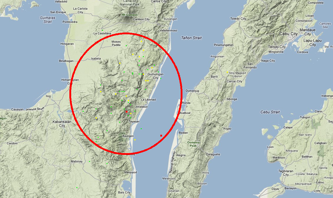
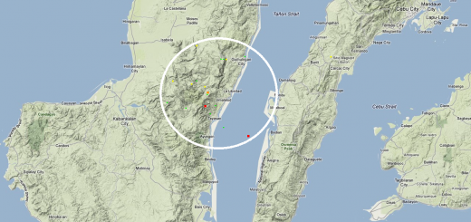
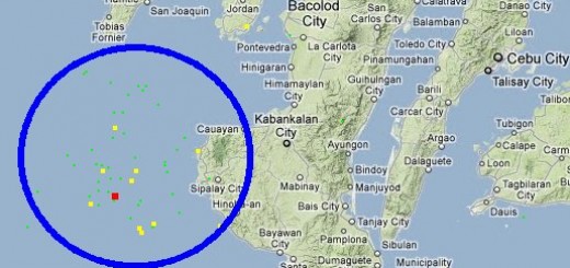
The earth continues to shake around Tayasan and Guihulngan in Negros Oriental. Every day since the initial shock on February 6, 2012 we count up to 20 earthquakes. The magnitudes range from 1.9 up to 5.2.
The map below shows the locations of the epicenters of this earthquake swarm. Click on the map to enlarge. This map is also available in an interactive form with additional information 
More and more information about damages reach us and show the destructive power of the earthquakes. Photo courtesy of Nobi. Thank you Nobi.

Usually roads are reinforced with a grid of steel-bars. We wonder, where the steel-bars of this road in Negros Oriental had gone?
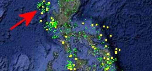
Since january 1, 2011 we monitor all earthquakes in the Philippines in real time and make the data available in form of a database and in form of maps.
The 2011 earthquake map is here
The 2012 earthquake map is here
Related posts
 January 1, 2013 Earthquakes 2012 in the Philippines Last year we recorded 1324 earthquakes in the Philippines. 10 of these quakes were dangerous and at least one of them created big damages […]
- March 9, 2012 Already 333 Earthquakes since January 1st, 2012 The underground in the Philippines is moving. There are currently 4 regions that experience nearly daily earthquakes: Negros, Mindoro, […]
- March 6, 2012 Strong Earthquake in Masbate A 5.2 magnitude earthquake jolted the provinces of Masbate, Albay and Sorsogon this morning at 07:06 morning.
The earthquake of tectonic […]
- February 7, 2012 The Earth continues to shake in Negros The earth still shakes in Negros and the southern Visayas. Most of the aftershocks can be felt even in northern Mindanao (Camiguin).
The […]
- February 6, 2012 A swarm of heavy Earthquakes shakes the Central Philippines As reported earlier, a swarm of heavy earthquakes with magnitudes 6.9 hits the central Philippines today. The epicenters of the […]


Recent Comments