Nasty weather in the south
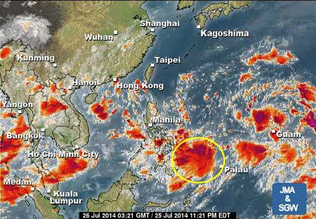
Nasty weather in the south of the Philippines. The slowly approaching Tropical Depression (TD) hovers east of Mindanao and brings heavy rainfall to the southern islands.
This Tropical Depression is moving very slowly towards the Philippines and will influence the weather in the south during the next days. This morning the TD’s center had been 840 km east of Mindanao. With the current forward speed this wet system will reach the Philippines in the first half of next week.
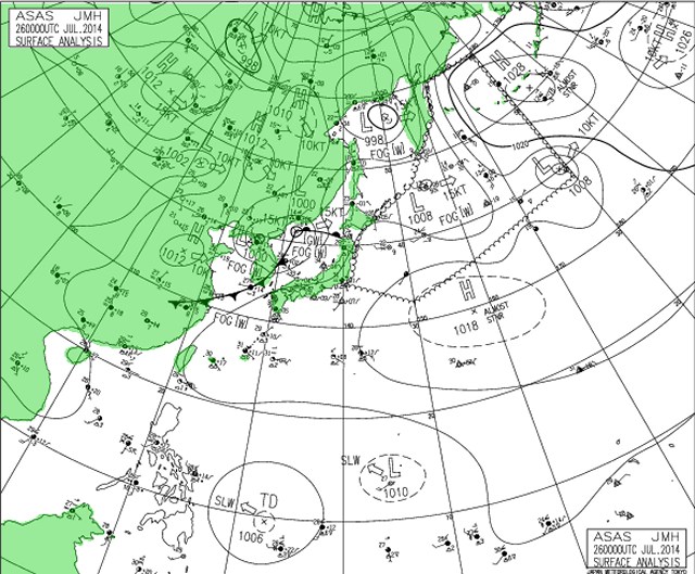
The second Low Pressure Are (LPA) is already more north. It became weaker and is slowly moving northwest. The probability that any of the two systems will become a cyclone in the next 24 hours is very weak.
As always, we’ll keep an eye on these wet guys. Meanwhile you may want to see their development in our 24 hours satellite loops.
[GARD]
Related posts
 September 11, 2013 Philippines Tourists Information The Bureau of Immigration has released a flyer with information about Visa, Exit Clearance Certificate and Procedures:
That's nothing […]
September 11, 2013 Philippines Tourists Information The Bureau of Immigration has released a flyer with information about Visa, Exit Clearance Certificate and Procedures:
That's nothing […]- October 1, 2013 Tropical Storm FITOW / Quedan enhances Habagat Tropical Storm FITOW / Quedan is strong but fortunately it moves far from the Philippine islands towards the southern islands of Japan. […]
- November 29, 2011 November – the haunted month of DoT Do you remember November last year? The DoT launched their worst campaign ever:
Pilipinas - Kay Ganda !
(see also here )
And […]
- May 8, 2013 Liquor ban in the Philippines – Alcohol Test in Swiss Parliament The next 5 days parts of the Philippines will be dry. From Thursday, May 9, until Monday, May 13, residents of Metro Manila are prohibited […]
- September 17, 2012 TOYOTA has again quality problems Our company car, a TOYOTA Innova G (2.5 DSL M/T), is 4 years old and has run 32,000 kilometers.
Every 5000 kilometers we have the […]


Recent Comments