Destructive Typhoon UTOR / Labuyo approaching Aurora
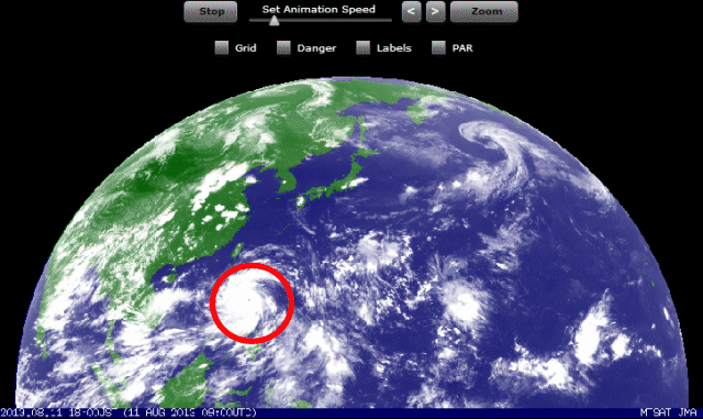
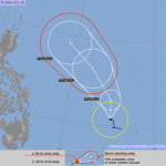
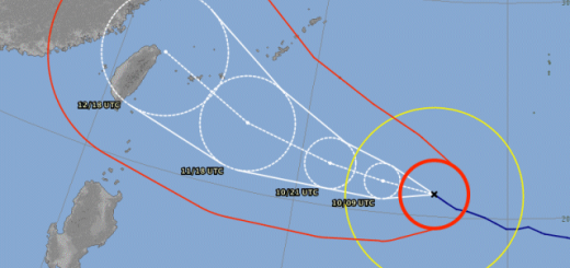
Typhoon UTOR / Labuyo is quickly approaching the region of Aurora in Luzon. Wind speed near the center is now 215 km/h and gusts go up to 260 km/h. The rainbands now cover whole Luzon. Landfall is expected near Casiguran early tomorrow morning.
DANGER: Wind gusts can go up to 260 km/h and heavy rainfall may trigger landslides and flash-floods. Look for shelter now!!!


Storm data:
| Name (INTL. / local): | UTOR / Labuyo |
| Class: | Typhoon Category 4 |
| Time/Date of observation: | 05:00 PM on August 11, 2012 |
| Location of Center: | 15.3º North 123.9º East |
| Moving Direction and Speed: | West-Northwest @ 24 km/h (fast) |
| Moving towards: | Aurora-Quirino Area |
| Distance from the Philippines: | 215 km from Casiguran, Aurora |
| Estimated Date / Time of Landfall: | Monday morning 02:00 – 03:00 a.m. near Casiguran |
| Max. Wind Speed near Center: | 215 km/h |
| Peak Wind Gusts: | 260km/h |
| Minimum Central Pressure: | 937 hPa |
| Diameter: | 555 km |
| 24h Rainfall near Center: | 350 mm |
| Max. Wave Height: | 12 m |
Here you find how to read and understand this data  |
|
Next update around 07:00 AM tomorrow morning.
Related posts
 October 18, 2016 Typhoon HAIMA/Lawin upgraded to category 4 becoming a Super Typhoon Typhoon HAIMA/Lawin has been upgraded to cyclone category 4. JMA has already attributed their highest category: VIOLENT
Typhoon […]
October 18, 2016 Typhoon HAIMA/Lawin upgraded to category 4 becoming a Super Typhoon Typhoon HAIMA/Lawin has been upgraded to cyclone category 4. JMA has already attributed their highest category: VIOLENT
Typhoon […]- October 17, 2015 Great Danger in Aurora – Typhoon KOPPU/Lando now Cat.4 Great Danger in Aurora - Typhoon KOPPU/Lando has now developed an eye and has been upgraded to Category 4. PAGASA has hoisted Storm SIgnal […]
- March 31, 2015 Typhoon MAYSAK now Category 4 Typhoon MAYSAK is now Category 4 Cyclone. The storm is still heading straight west at 20 km/h. It got much stronger during the last 12 […]
- October 10, 2014 Typhoon VONGFONG / Ompong a bit weaker Typhoon VONGFONG / Ompong got a bit weaker this morning. Its central pressure increased from 900 hPa to 920 hPa. Latest satellite images […]
- July 18, 2014 Tropical Storm MATMO/Henry Tropical Storm MATMO/Henry has intensified as it entered PAR. Tropical Storm MATMO/Henry is expected to continue moving slowly […]


Recent Comments