Cyclone KOPPU/Lando – full of surprises
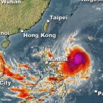
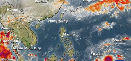
Cyclone KOPPU/Lando had been and still is full of surprises. First the good news – the storm is continuously weakening and it still stays off the coasts of northern Luzon. There are still strong winds over northern Luzon, but rainfall has much decreased.
The Surprises
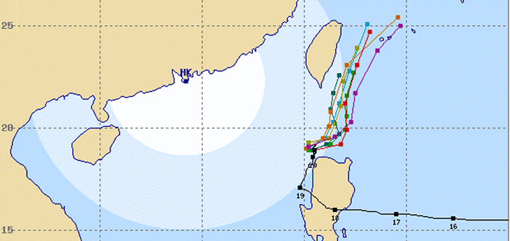
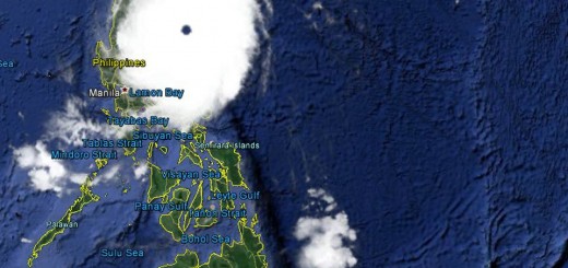
Already before having made landfall near Baler, Aurora, all meteorological agencies predicted that the cyclone will almost immediately move north crossing straight over de Cordillera. But KOPPU/Lando crossed over central Luzon, weakened to a Cat.2 Typhoon and went out in the sea near San Fernando, La Union. During all day yesterday, forecasters expected the storm coming back over Luzon. But the cyclone moved alongside northern Luzon’s west coast.
A second surprise has been the forward speed. All agencies expected the storm to move very slowly at some 3 to 10 km/h. Fortunately Cyclone KOPPU/Lando accelerated and moved at 15 to 20 km/h. Satellite photos also showed that the strongest rainfalls happened over the sea. Update 12:45 p.m. The storm has again slowed down and is almost stationary!
The 3rd positive surprise are the rainfalls. Initially Cyclone KOPPU/Lando poured big masses of waters over Aurora and Nueva Ecija. But as soon as storm moved out to the sea in the west (that’s diplomatically correct) the main rainfall happened over the open sea.
 |
 |
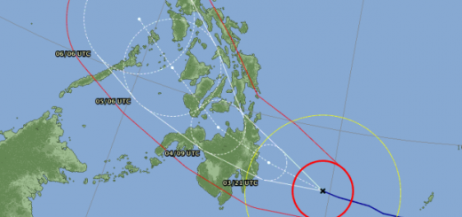
| October 18 track forecast | October 20 track forecast |
Rainfall
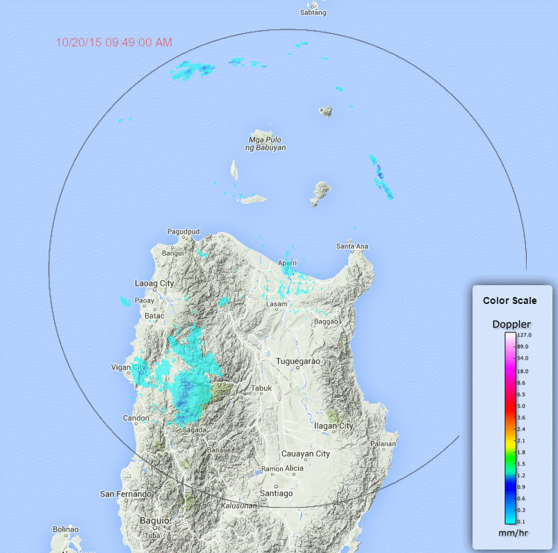
DOST’s Project Noah has been and still is a big help in evaluating rainfall. The Doppler Radars provided almost real-time rainfall maps. The Baler station was damaged or cut from the network as early as 11:30 p.m. on October 17. But Aparri, Subic and Tagaytay stations continued to provide us with extremely valuable information. Have a look into Project Noah, it is a state of the art tool but simple to handle. This mornings observation show only scattered and very light rainfall over the Mountain Province.
PAGASA Storm Signals
Storm Signal #2: winds of 61 to 120 kph within 24 hours
Ilocos Norte, Ilocos Sur, Apayao, Abra, Batanes, Northern Cagayan including Calayan and Babuyan group of Islands
Storm Signal #1: winds of 30 to 60 kph within 36 hours
La Union, Pangasinan, Benguet, Nueva Vizcaya, Ifugao, Mt.Province, Kalinga, Isabela and the rest of Cagayan
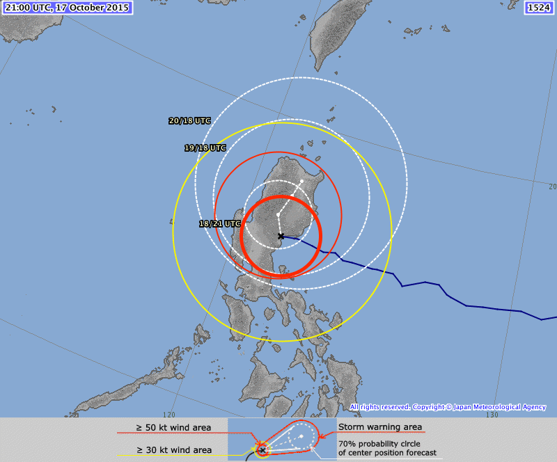
Cyclone KOPPU/Lando Storm data:
| Name (INTL. / local): | KOPPU/Lando |
| Class: | Tropical Storm |
| Time/Date of observation: | 12:45 PM on October 20, 2015 |
| Location of Center: | 19.1° North 120.1° East |
| Moving Direction and Speed: | Northeast, stationary again |
| Moving towards: | Batanes, Taiwan |
| Distance from the Philippines: | Near Ilocos Norte |
| Estimated Date / Time of Landfall: | n/a |
| Max. Wind Speed near Center: | 74 km/h |
| Peak Wind Gusts: | 110 km/h |
| Minimum Central Pressure: | 992 hPa |
| Diameter: | 560 km |
| 24h Rainfall near Center: | 100 – 300 mm |
| Max. Wave Height: | n/a |
| Here you find how to read and understand this data | |
Nearly real-time storm information
This seems to be our last report on this storm if there are no more surprises!
Related posts
 October 18, 2016 Typhoon HAIMA/Lawin upgraded to category 4 becoming a Super Typhoon Typhoon HAIMA/Lawin has been upgraded to cyclone category 4. JMA has already attributed their highest category: VIOLENT
Typhoon […]
October 18, 2016 Typhoon HAIMA/Lawin upgraded to category 4 becoming a Super Typhoon Typhoon HAIMA/Lawin has been upgraded to cyclone category 4. JMA has already attributed their highest category: VIOLENT
Typhoon […]- October 18, 2015 Too slow! Typhoon KOPPU/Lando creeps over land Too slow! Typhoon KOPPU/Lando moves only very slowly northwest. Forward speeds are between 3 and 9 km/h! The Typhoon continues to bring […]
- October 16, 2015 Typhoon KOPPU/Lando is now affecting the Philippines Typhoon KOPPU/Lando is already near and upgraded to Cat.2. PAGASA sees it 510 km off the coast of Aurora. The strong winds and heavy […]
- October 16, 2015 Typhoon KOPPU/Lando brings first heavy rains Typhoon KOPPU/Lando brings the first heavy rains to the Philippines. Winds on the north-east coast are now stronger than 30 knots (55 […]
- October 15, 2015 Tropical Storm KOPPU/Lando a bit slower Tropical Storm KOPPU/Lando advanced a bit slower than forecasts predicted. While still moving westward it gained a bit of strength. The […]


Recent Comments